**Newly Restored! August 2019** See below for details!


Find-A-Grave Listing : Click here to see before and after photos of each stone, plus genealogical information about the people buried here!
MOCA Code: OxBrf07
Location: 43.89847, -70.94084
From its intersection with Dugway Road, drive south on Potato Hole Road 0.5 miles and park near where the snowmobile trail crosses the road. The cemetery is about 100 feet to the right (west) of the road on a hill surrounded by a stone wall.
Historical Information:
There are many cellar holes in this area that belonged to the Quint, Rogers and Sargent families. Details can be found on the Historic Home Sites map.
Family links, either by blood or marriage, have been found for all the people buried in this cemetery besides Charles Heselton. (He and his parents were, however, living in one of the Rogers homes in 1860, though no family link has been found.) The main families buried here stem from Nathaniel Rogers, Daniel Sargent, Richard Sargent, and Joseph Quint Sr.

Condition (8/20/19):
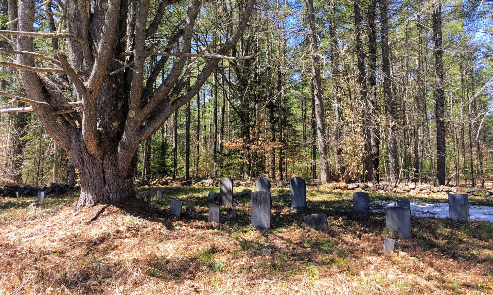
This cemetery had been neglected for many years and had fallen into disrepair. Many of the gravestones were broken and on the ground. Volunteers led by Jess Davis restored this cemetery in 2019. A government military marker for Civil War Soldier Samuel McDonald was applied for and set in place with help from Terry Blake. Samuel’s original gravestone had disintegrated. Samuel was married to Nancy (Quint) McDonald, who was the daughter of John and Rebecca (Sargent) Quint.
From the Brownfield Historical Society Newsletter:
Cemetery Restoration a Huge Success! By Jess Davis
On Saturday, August 17th, members of the Brownfield Historical Society, Mt. Moriah Masonic Lodge and other community volunteers descended on the Quint-Rogers Cemetery in a flurry of activity. Four hours of hard work later, almost all of the gravestones had been cleaned and reset.
Jess Davis, who has over 16 years of experience restoring cemeteries, organized and led this tremendous project. The first steps included probing the ground to find gravestones that had fallen and been covered by time. Two stones that were previously unrecorded were found in this manner. Next she uncovered all the bases for the stones and matched the gravestones to the correct locations. Assessments were done on each stone to determine how they would be reset. Seven gravestones required aluminum channel bracing due to breaks and weakness.
The site was prepared by landowner Terry Blake, which revealed many unmarked graves. While there are fewer than thirty carved headstones in this family cemetery, there are at least fifty graves. Some are marked with simple fieldstones at the head and foot of the grave, while others are only detectable by the depression caused by the coffin collapsing over time. A map of the cemetery and a spreadsheet of known burials can be found at www.brownfieldcemeteries.com.
While some volunteers cleaned gravestones with soft scrub brushes and water, others began resetting the heavy bases of the gravestones. Eventually the stones were able to be reset in their bases using sand mortar. Thanks to the Town of Brownfield, Jess was able to purchase supplies for this project, including gravestone braces from Ela Sheet Metal. These aluminum braces are designed to hold broken stones without actually attaching to the stone itself. All processes used by the volunteers adhered to accepted “Do No Harm” conservation practices.
If you have a chance, please visit this peaceful cemetery off of Potato Hole Road. A big thank you to our hard-working volunteers! More cemetery projects are being planned for next year, so if you missed this one, you can still play a part in the next one!
Spreadsheet of Burials:
